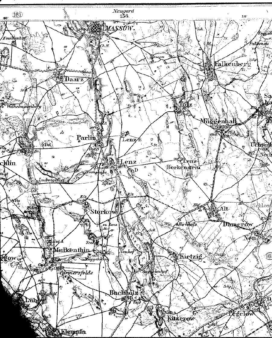
A detailed 1893 map showing parts of the counties (Kreise) of Naugard and Saatzig, Pomerania. [map covers an area of about 7.5 x 9 miles. Villages south of Parlin, Tolz and Falkenberg are in Kr. Saatzig.]
Friedrich and Bertha Köhler family lived in the villages of Alt Damerow, Buchholz, and Kitzerow from about 1853 to 1866.
From the Library of Congress collection of historic 1:100,000 scale topographic maps of Germany. Karte des Deutschen Reiches, Reichsamt fur Landesaufnahme, Berlin.
| Map to the north | Map to the south | Map to the east | A 1:350,000 scale map |
| Back to Pomerania | Table of Contents | Home |