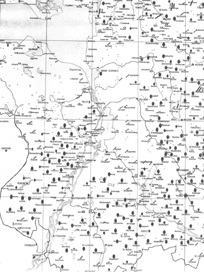
Map showing villages in parts of Randow, Greifenhagen and Naugard counties (Kreise) in the 18th century.
Hohenselchow and Pinnow are in the lower left grid cell about 20 miles southwest of Stettin which is located approx. in the center of the map.
From the Historischer Atlas von Pommern, Karte 3, Karte der Historischen Dorfformen, 18 Jahrh., Vol. 3, 1963.
[Scale on original map - 1:350,000] Distance between vertical lines is 0.25 degrees or about 10 miles at this latitude.