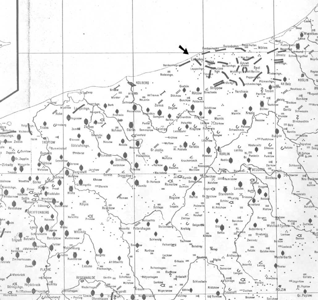
Map showing villages in parts of Greifenberg, Kolberg Körlin, Köslin, Regenwalde and Schivelbein counties (Kreise) in the 18th century.
Lassehne lies on the Baltic coast (see arrow) about 10 miles northeast of Kolberg.
Ornshagen is about 4 miles southwest of Regenwalde in the lower left portion of the map.

From the Historischer Atlas von Pommern, Karte 3, Karte der Historischen Dorfformen, 18 Jahrh., Vol. 3, 1963.
[Scale on original map- 1:350,000] Distance between vertical lines is 0.25 degrees or about 10 miles at this latitude.